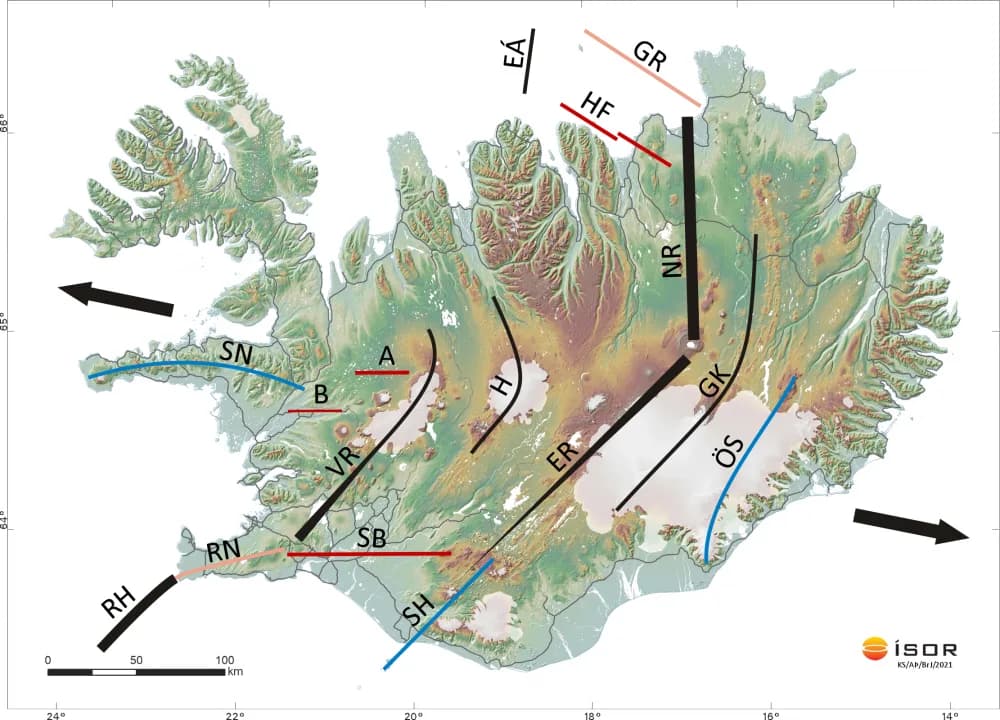
On the map the main tectonic elements in Iceland are shown. The rift belts in Iceland (black) shift to the east from the Reykjanes Ridge (RH) and Eyjafjarðaráll (EÁ). This happens across the South Iceland transform belt (SB) and another transform belt named after Tjörnes (HF) between Húsavík and Flatey. The fracture belts on Arnarvatnsheiði (A) and in Borgarfjörður (B) are of the same nature. They connect between the Western rift belt (VR) and the Snæfellsnes flank belt (SN). The Western (VR), Eastern (ER) and Northern rift belt (NR) are shown black. VR and ER are shown as wedges. This is to indicate increasing rifting, on the one hand to the south-west in VR and on the other to the north-east in ER. Over Central Iceland lie volcanic systems. The main ones are indicated by H (Hofsjökull) and GK (Grímsvötn-Kverkfjöll). Oblique rift belts are shown in pink, on the one hand the Reykjanes peninsula (RN) and on the other its mirror image, the Grímsey-Axarfjörður belt (GR). The flank belts of Snæfellsnes (SN), South Iceland (SH) and Öræfajökull-Snæfell are shown in blue. The thick arrows show the spreading direction. The spreading rate is about 1 cm per year in each direction.
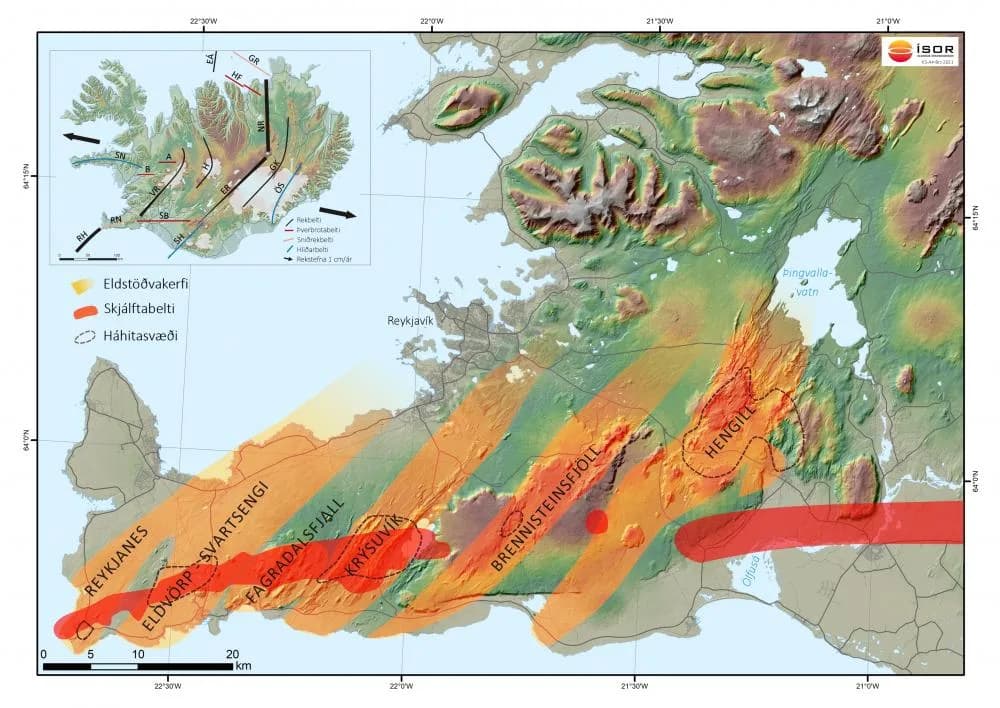
On the Reykjanes peninsula the transform component appears in north-south fractures a few kilometres long with horizontal displacement and fracture hills. They are on a narrow belt that runs along the entire length of the peninsula. There earthquakes frequently occur. They come in swarms and most are small. The most powerful has been about magnitude 6. Periods of volcanic eruptions and rifting movements on the one hand and transform movements on the other alternate and each lasts 6-8 centuries. The period of transform movements has been going on for the last centuries, but there are indications that it is coming to an end.
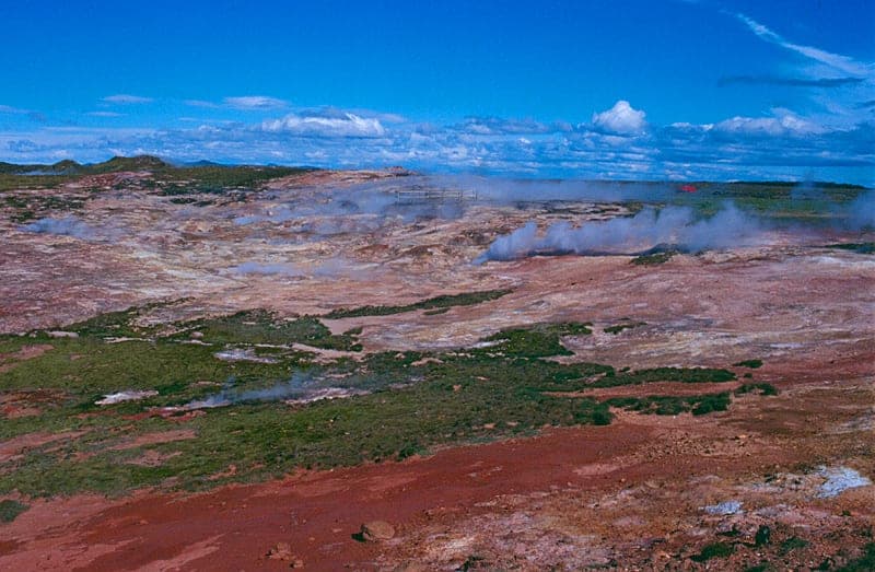
On the Reykjanes peninsula there are six volcanic systems. Their centre is determined by the greatest lava production in fissure eruptions. The fracture swarms of the volcanic systems, with fissures and faults, are much longer than the eruption fissure swarms. There magma intrusions (dykes) from the central volcanoes have not reached the surface. In five of the volcanic systems there is a high-temperature area. Their heat source is intrusions high up in the crust. Drilling in the high-temperature areas has shown that 20-60% of the rock below 1000-1600 m is intrusions. Acidic rock and calderas are not present in the volcanic systems of the peninsula. There is, however, a weak indication of a buried caldera in the Krýsuvík area, and in Hengill acidic rock occurs in the central volcano, but that is north of the triple junction of the plate boundaries (the volcanic-belt junction). The petrology of the eruptive rock in the volcanic systems spans the range from picrite to quartz tholeiite.
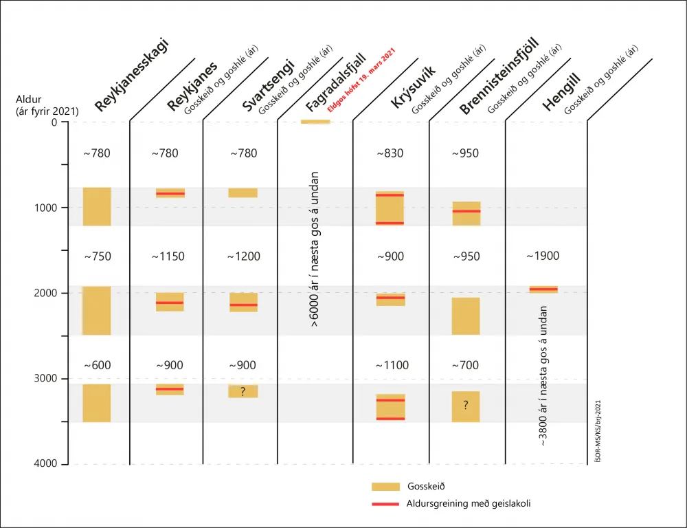
Volcanic and rifting periods
Research shows that volcanic and rifting periods (eruption episodes) occur every 6-8 centuries on the Reykjanes peninsula. The volcanic activity is characterised by fires that can last several decades, with pauses. The volcanic systems have generally not been active simultaneously, but rather volcanic activity has moved between them one after another. Each volcanic system becomes active every 900-1100 years. About 950 years have passed since the last eruption in the Brennisteinsfjöll system, but 780-830 years in the western systems. Research indicates that the last eruption episode began with fires in Brennisteinsfjöll and on the Trölladyngja swarm of the Krýsuvík system shortly before the year 800. After that burst came about a 150-year pause until volcanic activity picked up again in the Brennisteinsfjöll system in the 10th century. After that followed the Krýsuvík system in the 12th century. Finally it erupted on the westernmost systems of the peninsula, the Reykjanes and Svartsengi systems, in the 13th century. Those fires ended about the year 1240. The Brennisteinsfjöll system has been the most active of the volcanic systems of the Reykjanes peninsula since the Ice Age and has produced the most lava, both in area and in volume.
The periods of volcanic eruptions are found by age-dating lavas with the help of tephra layers and C14 age-datings, plus recorded sources about eruptions after the settlement. The two last eruption episodes are well known and the third, about 3000 years ago, partly. There are indications of more eruption episodes before that, but age-datings are still too few as yet to date them precisely.
Summary in 2010: Kristján Sæmundsson, geologist, ÍSOR. Updated in 2021: Magnús Á. Sigurgeirsson, geologist, ÍSOR.