A number of faults lie over the Námafjall area, often no more than 200-300 m apart and even closer in the most active fracture swarm that runs through Bjarnarflag. There the correlation between springs and faults is clearest. It is also present on Námafjall, but is more dispersed there. The same applies to Hverir (Hverarönd) east of Námafjall. The Námafjall area is a very active eruption area. South of Krafla the activity decreases over a few km stretch, but it picks up again with eruption fissures that are mainly in the wider surroundings of Bjarnarflag and in Námafjall on the west.
What is considered worth seeing there is the view west from Námaskarð to Hverfell over striped sand and lava expanses after an unsuccessful revegetation effort, and to Mývatn with rare architecture closest in the foreground, and north of the road altogether more magnificent signs of human activity where there are boreholes, an effluent lagoon and pipes for a diatomite plant and power station. On the east side of the mountain are the mud pots and the old steam boreholes in what is now called Hverarönd. A popular walking route runs from below at Hverir up onto Námafjall by the sulphur mounds at Námakolla, but they get no larger than that. Much more is worth seeing there, such as the tuff stacks south of Jarðbaðshólar and the spatter craters on the eruption fissure from 1728 west on Jarðbaðshólar.
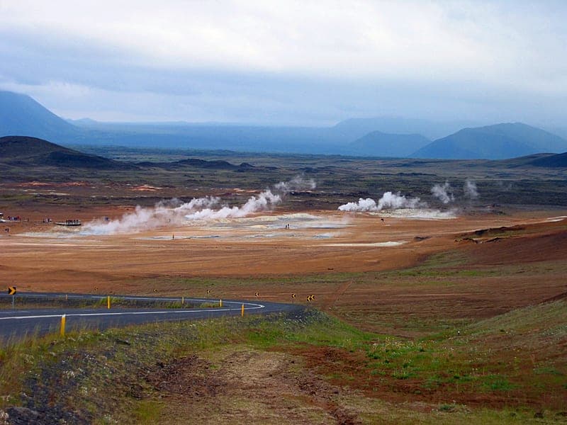
On calm, cold days steam rises in many places from the lavas west and south of Bjarnarflag. There vapour rises off a hot groundwater stream that runs to Mývatn. Earth baths were formerly in Jarðbaðshólar, but now somewhat farther south, and a highly valued health resort still as before. There has been a bathing place in Grjótagjá and its offshoot farther south since it was found a little over 60 years ago, and before that in Stóragjá.
Drilling in Bjarnarflag has revealed a geothermal system with very favourable production characteristics. The production suffered setbacks in the Krafla fires of 1977 when most of the wells were destroyed by fractures and magma that blocked them. Two wells that were later drilled east of the disturbance area have sufficed for the operation up to now. The production has so far not measurably depleted the reserves, and plans are therefore naturally being made for a larger steam power station in the area, that is, in Bjarnarflag at first, where the production characteristics are known.
Source: Kristján Sæmundsson, ÍSOR.