The spring activity in the four aforementioned geothermal areas is in various respects different.
In Krýsuvík the spring activity is most continuous in Hveradalir and at Seltún and somewhat up onto the ridge, with steam and mud pots. There is a fair amount of sulphur springs and large gypsum deposits. There are also springs in Grænavatn. From Grænavatn and Gestsstaðavatn eruption fissures run with more craters to the north, one heading up into Hveradalir and the other to the springs at Seltún. The highest temperature in boreholes is in Hveradalir, about 230°C. The deepest drilling has been about 1200 m. The temperature is near the boiling curve down to ~300 m depth, but below that it cools. There are no measurements from boreholes below 400 m.
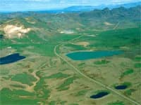
At Austurengjar the geothermal heat is mainly on one line that runs from Austurengjahver north into Kleifarvatn. Considerable alteration is seen in the rock quite far out on both sides. In addition to the geothermal heat there are on this thermal line several explosion craters that have erupted scoria and small lavas with the ejecta. The largest is about 100 m in diameter a short way north-east of Stóra-Lambafell, and there is much scoria spread east from it. These craters are from early in the present. One 600 m deep borehole is at Kleifarvatn about 150 m west of the spring line. The highest temperature in it is about 160°C. In late summer 1924 Austurengjahver came to life with an earthquake but was previously insignificant. Large hydrothermal explosion craters are north of it but older, which indicates that the geothermal system near boiling lies shallow, as in Krýsuvík.
Köldunámur is the name of an area west on Sveifluháls far north of the geothermal heat in Krýsuvík. A short way west of there are steam vents in a lava hollow and some sulphur (Leynihver), but on the slope a cold geothermal patch. Gypsum debris is seen, indicating that there were sulphur springs there at some time.
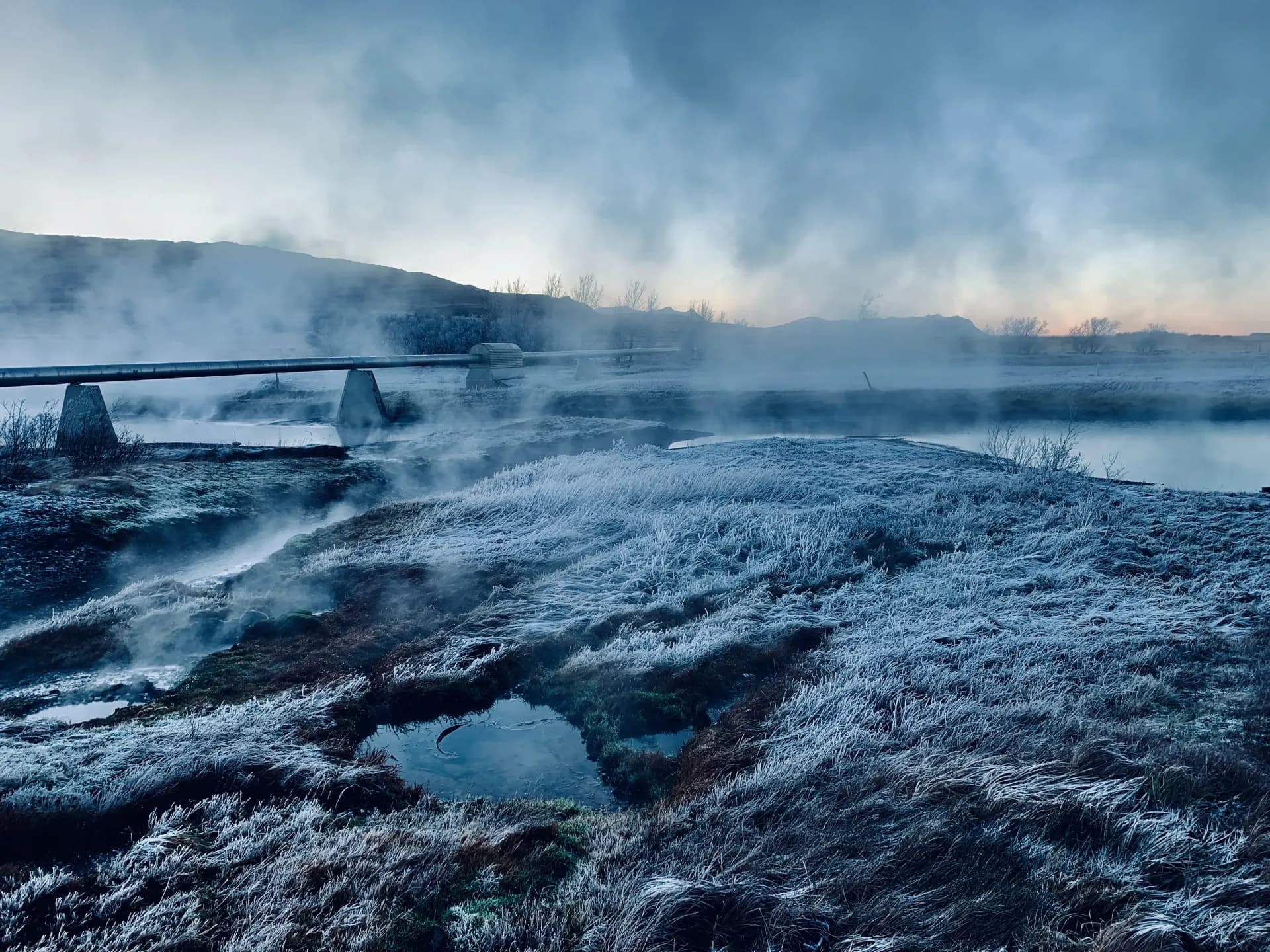
In Trölladyngja the springs and alteration are most continuous on a strip that runs from Djúpavatn in the east west to Oddafell. The spring activity is fairly faint, two springs up by the Sog, steam with a little sulphur, and a hydrothermal explosion crater below the ridge and thermal patches in Oddafell. Explosion craters and large scoria craters are on eruption fissures where they lie over the aforementioned E-W strip. Alteration is greatest in the Sog, where a large area is altered into sticky clay. West on the ridge from the Sog, south as far as Hverinn eini, the tuff is also altered, but nowhere near as much as in the Sog. There are large explosion craters from the Ice Age and water in some. Djúpavatn formed in the same way. Calcareous crust is found in two places. A thermal line with steam vents runs from Trölladyngja via Eldborg north into Lambafell, bound almost to a single fracture. Hverinn eini is in lava a short way south-west of the SW end of Oddafell. A steam vent with a little sulphur is in a lava hollow and steam over a small area around it. Nearby is a small sinter mound (silica) and cold spring holes in it. In Trölladyngja there are two boreholes, one at the spring fracture north below it and the other on the geothermal area west below the ridge. Both give about 260°C temperature higher up, then a temperature decline, but the deeper well ends in 320°C temperature at a little over two km depth.
The geothermal heat named after Sandfell is in lava north-east below the hill. There steam vapour rises feebly in several places. On a patch there is clay-like alteration in the soil, and there the temperature has been measured near boiling. The tuff in Vesturháls is somewhat altered opposite Sandfell and inward along Selvellir, and there are vegetated slopes with running streams. Up on the high ridge opposite the steam at Sandfell there is a fairly large, clay-yellow geothermal patch but completely cold. The area could accordingly be larger than it appears from the surface signs.
The temperature decline in boreholes after a depth of a few hundred metres is reached has raised the question of where the upflow is to be sought. The drilling in Trölladyngja indicates that there it is to be sought under the Sog. In Krýsuvík it would best be sought under Sveifluháls. The Austurengjar heat is on the outer edge of the geothermal system according to resistivity measurements, like the Trölladyngja wells on the west side. The area where resistivity measurements detect high resistivity beneath low need not describe the present state, since they cannot tell the difference between what was and what is >240°C hot.
Source: Kristján Sæmundsson, ÍSOR.