News
Magnetic measurements with a drone
ÍSOR · 22 October 2025 · 2 min read
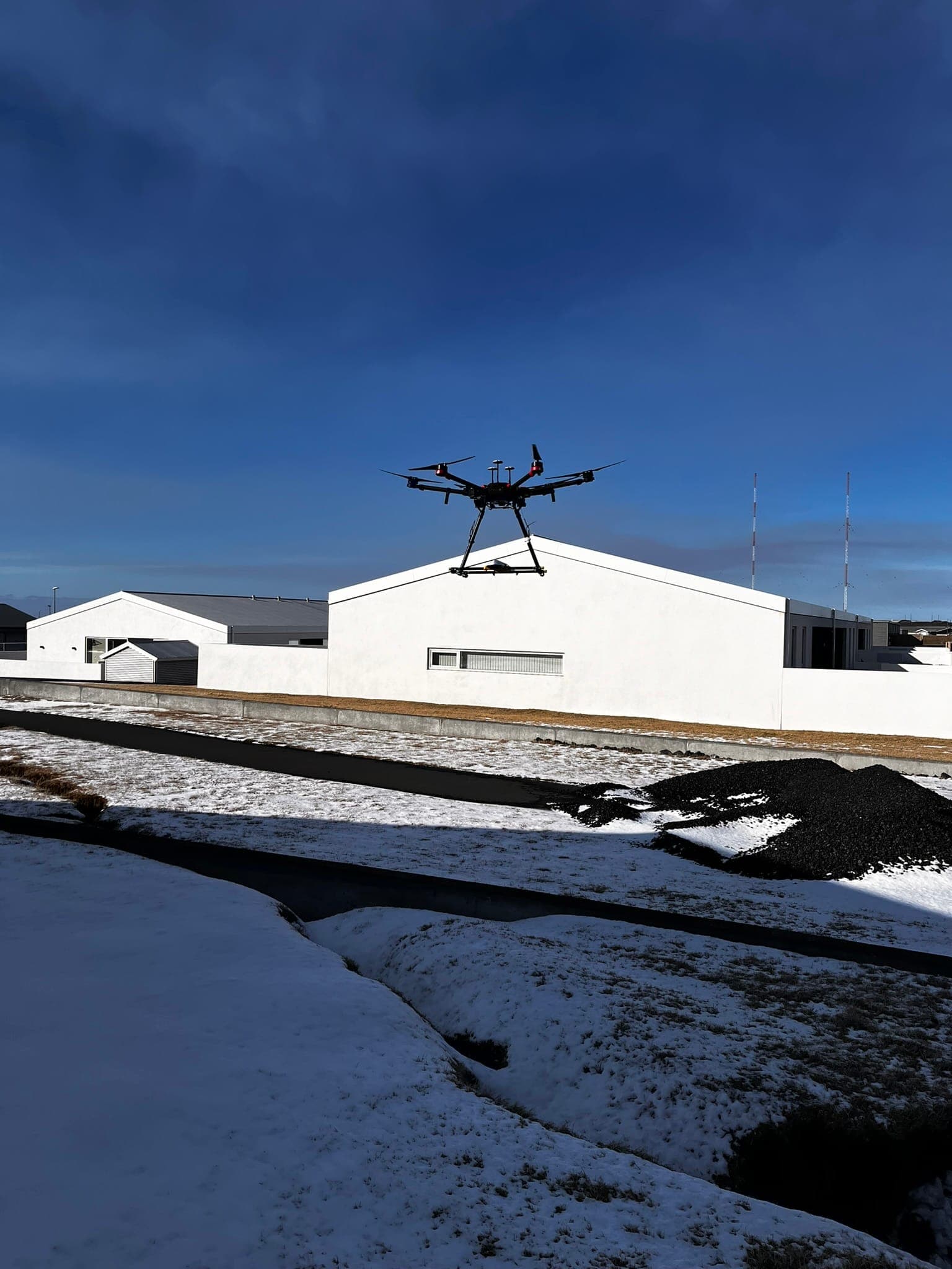
This year ÍSOR invested in a new drone and magnetometer that offers even greater advances. The first measurements with the new equipment took place in Eyjafjörður last week, where measurements were made in the geothermal areas at Botn and at Hjalteyri. 380 km were flown over two days and about 6…
This year ÍSOR invested in a new drone and magnetometer that offers even greater advances. The first measurements with the new equipment took place in Eyjafjörður last week, where measurements were made in the geothermal areas at Botn and at Hjalteyri. A total of 380 km were flown over two days and about 6 km² were mapped, flying at 25 and 50 metres altitude, with 50 metres spacing between measurement lines.
For many decades ÍSOR, and its predecessors, have gathered data with magnetic measurements for geothermal exploration. On land the measurements have usually been carried out by walking with a magnetometer, but measurements have also been made from an aircraft when more extensive mapping was needed, though at considerably greater cost and lower resolution.
Magnetic measurements have been carried out with a drone in Iceland since 2020, using a drone and magnetometer that were purchased with a grant from the Infrastructure Fund of Rannís in 2020 and are jointly owned by the University of Iceland, Reykjavík University and ÍSOR. That drone, together with a magnetometer, can be seen in flight in Grindavík in figure 1 and during measurements at Bæjarfjall near Þeistareykir in 2023 in figure 2.
In recent years drone technology has opened up new possibilities in geoscientific research. During this decade ÍSOR has used this technology for magnetic measurements, among other things in connection with geological investigation due to the volcanic events in Grindavík, for mapping intrusive rock in low-temperature areas and for analysing magnetisation, and demagnetisation, of rock in high-temperature systems.
The aim of the measurements at both Botn and Hjalteyri is for the results to give indications of the location of fractures and dykes that are concealed beneath the surface. This yields a new dataset that adds to the understanding of the geothermal systems and is useful in joint interpretation with other data, both that gathered from the surface and through observations in boreholes.
With the new device the effective flight time of each charge increases from about 10 minutes to 35-40 minutes, in addition to which the drone's sensors better detect collision hazards and the drone can respond better to conditions that may arise in flight. This makes it possible to gather data at lower flight altitude, which is crucial for detecting smaller deviations in the magnetic field.