News
Conference and cooperation of Íslenskar orkurannsóknir and the University of Akureyri with scientists from Expedition 396 within the International Ocean Discovery Program.
ÍSOR · 2 September 2024 · 2 min read
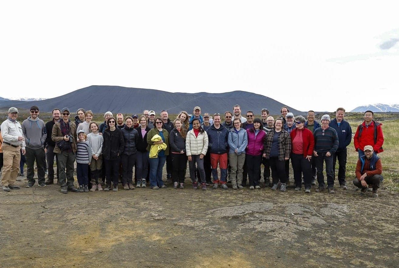
Íslenskar orkurannsóknir and the University of Akureyri held a conference in June about their research with scientists from Expedition 396 within The International Ocean Discovery Program (IODP), together with a two-day field trip in Northeast Iceland. The conference took place on 17–21 June at the…
Íslenskar orkurannsóknir and the University of Akureyri held a conference in June about their research with scientists from Expedition 396 within The International Ocean Discovery Program (IODP), together with a two-day field trip in Northeast Iceland. The conference took place on 17–21 June at the University of Akureyri.
At the conference, the main results of the expedition and newly published research products were discussed, in addition to which opportunities and partners were sought for the follow-up research that is on the drawing board. In Expedition 396, drill cores were taken from 21 research boreholes from the seabed on the Vøring Plateau east of the Jan Mayen Ridge, in an area that holds unique examples of volcanism at plate boundaries and provides insight into the processes that led to the opening of the NE Atlantic and the formation of Iceland.
The main purpose of the expedition was to test the hypothesis that the thermal maximum at the boundary of the Paleocene and Eocene epochs (the Palaeocene–Eocene Thermal Maximum) occurred due to the release of carbon caused by geothermal heat that came about due to magma intrusions and/or eruptions that had a large-scale effect on the Earth's climate about 56 million years ago.
On the seabed off North Iceland, magnificent traces of volcanic eruptions and crustal movements can be found in many places, and from them, among other things, their effects on climate and ecosystems can be assessed. The data gathered during the expedition give new insight into the petrology of the area and make it possible to better define the geophysical models that explain the rapid formation of large igneous slabs and their effects on adjacent systems, as well as on a global scale. Comparison of the data from beneath the seabed with geographical forms in Iceland gives further insight into the formation history of the area. Research such as this increases our understanding of the effects of large-scale volcanic eruptions on landscape formation, climate and biota, in addition to providing a basis for practical research, such as regarding carbon sequestration and geothermal utilization.
The scientists of Expedition 396 are internationally recognized experts from 14 nations, among other things in seabed geology, volcanology, petrology, climatology, seabed drilling and more.
Further information is provided by:
Anett Blischke, geologist and geophysicist at ÍSOR [email protected] 845 9002