News
Submarine lava and craters by Grindavík
ÍSOR · 12 November 2023 · 2 min read
Earthquakes and uplift in the vicinity of the mountain Þorbjörn above Grindavík have put people on alert for volcanic eruptions in the vicinity. For that reason, people have also scrutinized geological data and old accounts of eruptions in these areas.
Earthquakes and uplift in the vicinity of the mountain Þorbjörn above Grindavík have put people on alert for volcanic eruptions in the vicinity. For that reason, people have also scrutinized geological data and old accounts of eruptions in these areas.
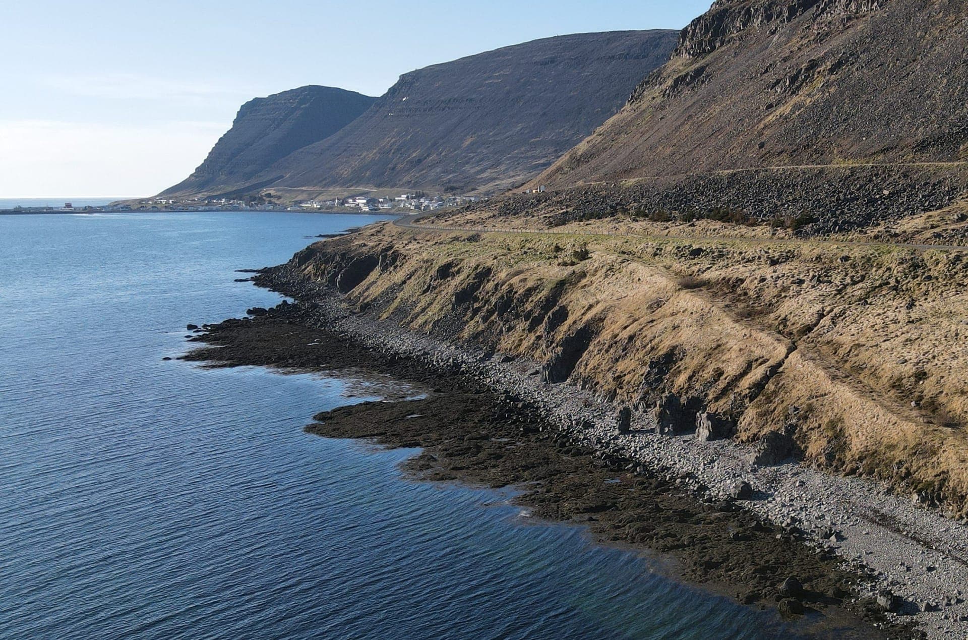
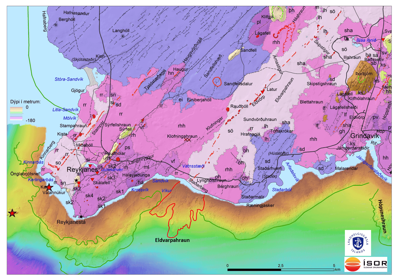
The youngest eruptive episode, the Reykjanes Fires, occurred during the period 1210-1240, that is, about 800 years ago. At that time there were submarine eruptions off Reykjanes and lavas flowed on land both on Reykjanes and at Svartsengi. One of these lavas was Eldvörp lava west of Grindavík. The crater row, Eldvörp, is about 8 km long and reaches all the way south to the coast at Staðarberg and there lava flowed into the sea.
In multibeam bathymetric measurements, which the Icelandic Coast Guard has acquired with the survey vessel Baldur and provided to ÍSOR for further processing, it can be seen that the lava did not stop at the coast but rather flowed a long way underwater and there forms beautiful tongues of rugged lava. At its farthest it reaches about 2.7 km out from the coast and there reaches a depth of about 90 m. It is possible that the eruptive fissure also extends beyond the coast and that there was also an eruption in the sea there. The area of the lava on the seabed is about 3.4 km2. Lava of this kind is by no means unique. The Hópsnes by Grindavík is part of a lava that has flowed down to the coast and formed a fairly large spit out into the sea. It is about 8,000 years old. In images it can be seen that it continues underwater and forms a lava tongue that reaches down to a depth of about 100 m.
In bathymetric measurements acquired on the Reykjanes Ridge and the Kolbeinsey Ridge, it can be seen that lava can flow on the seabed from craters and eruptive fissures at considerable depth. These are believed to be so-called pillow lavas or pillow lava sheets.
In order for lava to flow in this manner, it needs to protect itself against cooling by the sea. They appear to form an insulating shell of scoria and solidified rock as they flow forward. It is clear that the lava flow needs to be large and steady for a lava tongue to form on the seabed. Under such conditions it would be impractical to stop a lava flow with seawater cooling.
Readers are referred to further information about the geology and a historical overview of the lavas on the Reykjanes Peninsula on ÍSOR's website and in ÍSOR's geological map viewer.
www.isor.is www.jardfraedikort.is