News
Geological and geohazard mapping of coastal areas in Seyðisfjörður and Norðfjörður
ÍSOR · 19 April 2022 · 1 min read
Last year ÍSOR – Iceland GeoSurvey received a grant from the Icelandic Road and Coastal Administration's Research Fund to work on geological and geohazard mapping of coastal areas in Seyðisfjörður and Norðfjörður. The main goal of the project is to shed light on the size and extent of submarine…
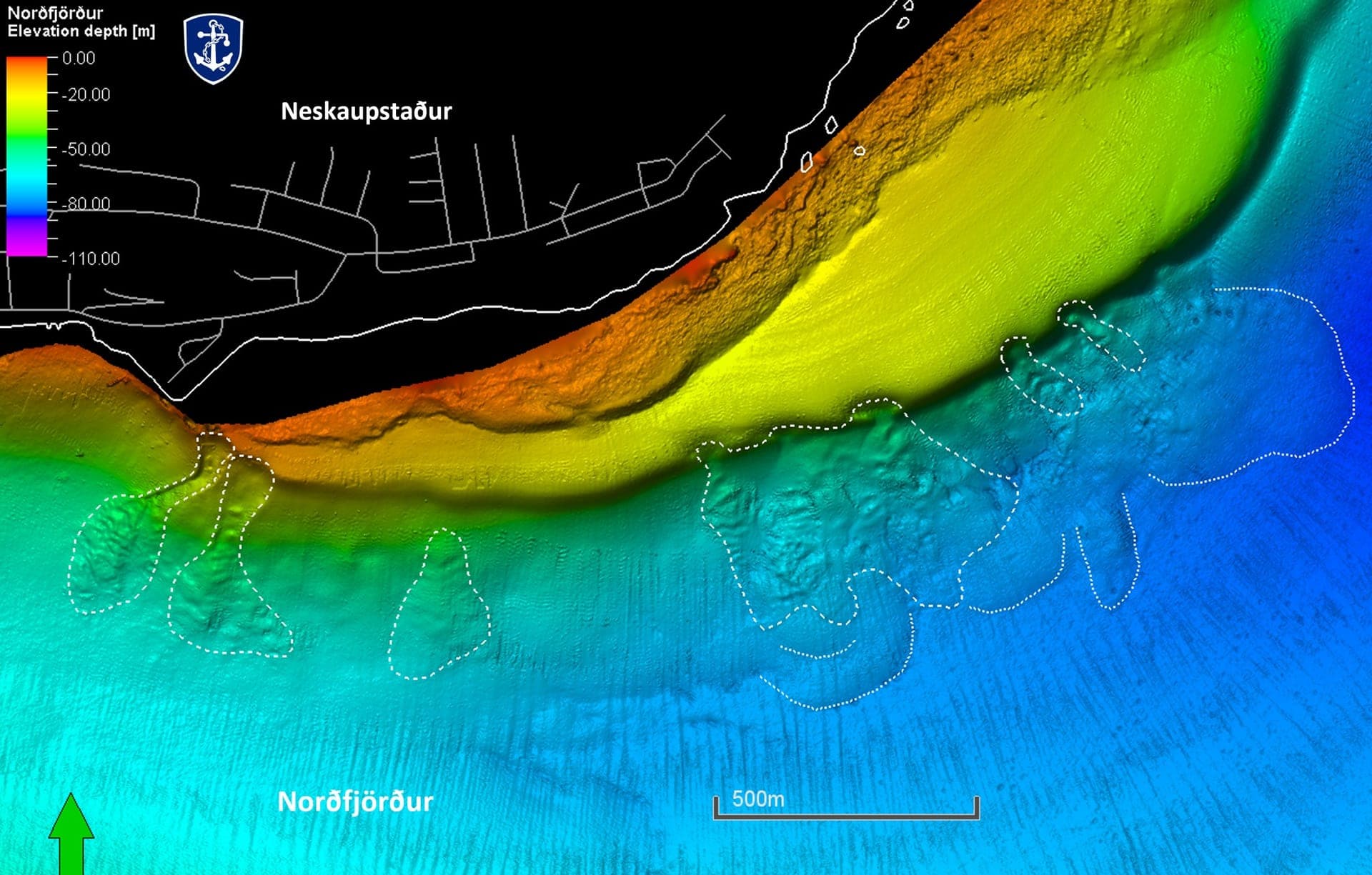
Last year ÍSOR – Iceland GeoSurvey received a grant from the Icelandic Road and Coastal Administration's Research Fund to work on geological and geohazard mapping of coastal areas in Seyðisfjörður and Norðfjörður. The main goal of the project is to shed light on the size and extent of submarine landslides, as well as to map and improve knowledge of the bottom type and coastal type of the fjords. ÍSOR recently delivered a report along with three different maps of both fjords, namely a geological and geohazard map, a bottom-type map and a coastal-type map. The results will be made accessible on the website of the Road and Coastal Administration https://www.vegagerdin.is/upplysingar-og-utgafa/, and in the accompanying figures one can see landslides in Norðfjörður and Seyðisfjörður.
There are no confirmed cases from historical time of submarine landslides in Icelandic fjords, but this research shows that such landslides have occurred in earlier times. They also indicate that where landslides have fallen, there is a likelihood that they will recur. This is a natural hazard that needs to be kept a watchful eye on. The results are useful for general assessment of geohazards and environmental impacts and regarding planning, site selection and various works in or by the sea.