News
EMODnet conference and workshop on seabed geology held in Iceland 3–6 June 2025
ÍSOR · 2 June 2025 · 3 min read
Íslenskar orkurannsóknir (ÍSOR), in cooperation with the University of Iceland and the Geological Society of Iceland, will hold a conference and workshop of the EMODnet-Geology project, for the first time in Iceland. In the first week of June, 55 geoscientists from 26 European geological…
Íslenskar orkurannsóknir (ÍSOR), in cooperation with the University of Iceland and the Geological Society of Iceland, will hold a conference and workshop of the EMODnet-Geology project, for the first time in Iceland. In the first week of June, 55 geoscientists from 26 European geological institutions and research bodies will come together to discuss current and possible future projects of seabed research and the continued development of a database. This is a collaborative project that has been funded by the European Commission since 2009 and involves the cooperation of more than 40 geoscience institutions, universities and research institutions, which ensures comprehensive expertise in seabed geology and covers large marine areas.
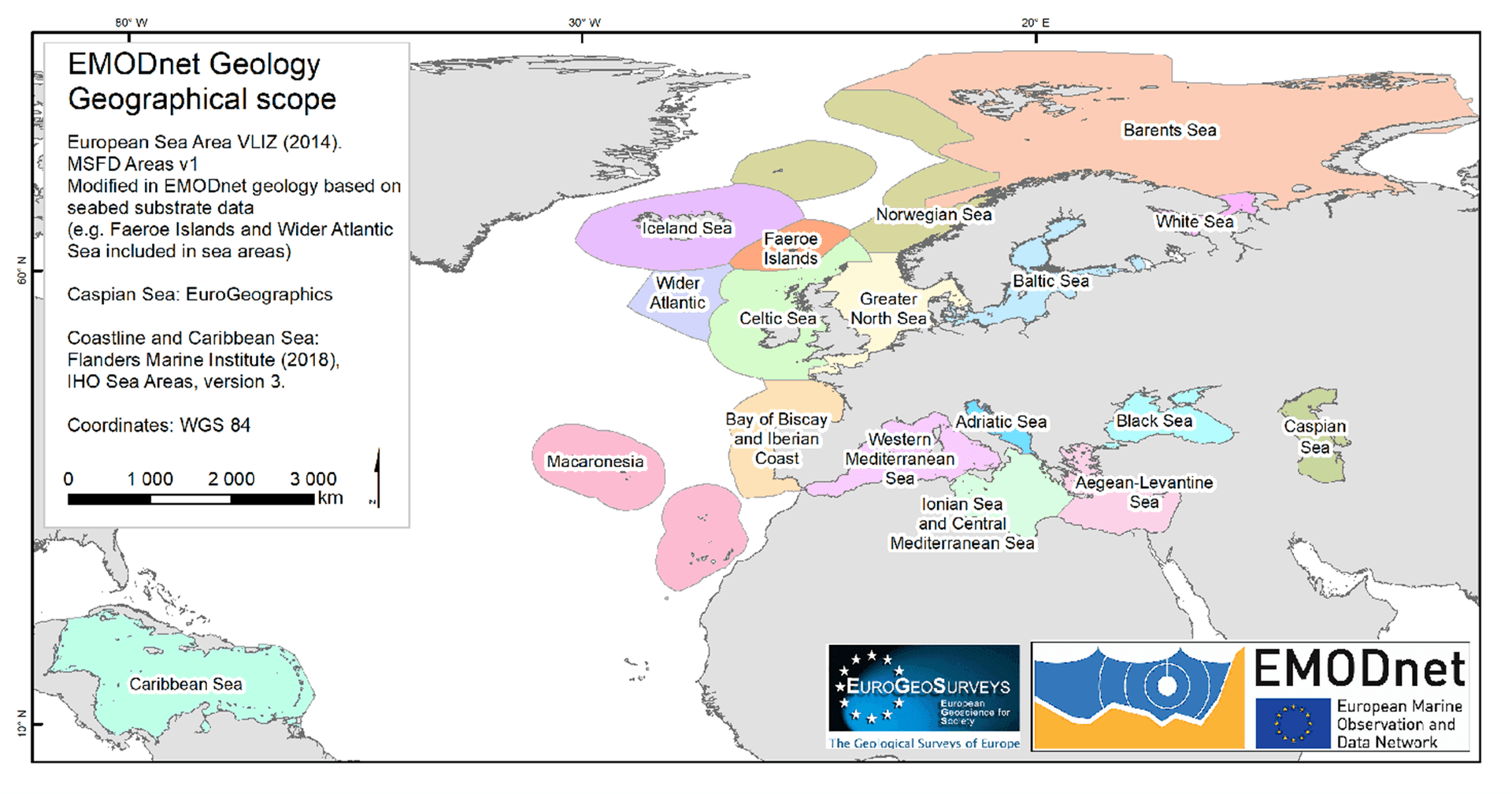
EMODnet is a database service of the European Union, under the responsibility of the Directorate-General for Maritime Affairs and Fisheries (DG MARE) and is funded by the "European Maritime Fisheries and Aquaculture Fund." The project consists of an extensive network of more than 120 institutions working to collect, harmonize and make accessible data on the seas and seabed, as well as to produce thematic maps and metadata. EMODnet-Geology is one of seven broad expert projects under the umbrella of the EMODnet service, and ÍSOR takes part in it on behalf of Iceland. Other expert projects are bathymetry data, which HAFRÓ (the Marine and Freshwater Research Institute) attends to on behalf of Iceland, biology, chemistry, human activities, physics and seabed habitats.
The main goal of EMODnet-Geology is to collect, harmonize and provide access to geological seabed data from European sea areas and thereby support the sustainable utilization and management of resources. Data from various European parties are harmonized and made accessible through the EMODnet web portal.
The data are used, among other things, in scientific research work, practical applications and policymaking by authorities, including on marine spatial planning, environmental impact assessment and resource utilization. The project also supports the gathering of data that provide insight into the movements and development of coastlines as well as natural hazards, and thus are useful in shaping effective protection measures. The main data sets being worked on under the EMODnet-Geology project deal with mapping of the seabed surface (bathymetric maps), sedimentation, the geological makeup of the seabed, changes in coastal areas, natural hazards such as earthquakes and submarine landslides, resources on the seabed such as metals and geothermal energy, landscape and geological history, where measurement data from drilling, sampling and geophysical measurements are used.
By providing access to harmonized geoscientific seabed data, EMODnet-Geology has played a key role in increasing knowledge that promotes the sustainable utilization of marine and seabed resources in Europe. ÍSOR's participation on behalf of Iceland in this project has already resulted in important products, maps and data sets that are useful in various projects of authorities, institutions, the scientific community and other stakeholders. ÍSOR will continue to take part in the EMODnet project and thereby contribute to ensuring that this important project adds to knowledge and supports Iceland's interests in the field of seabed research and resource utilization for the future.
The organizers of the conference are Dr. Anett Blischke, geologist, [email protected], and Ögmundur Erlendsson, geologist, [email protected].